
IV. John George Bartholomew
Brought the firm to its zenith with many innovative projects [1][2]
John George Bartholomew (1860–1920), was born on 22 March 1860 at 10 Comely Green Place, Edinburgh. He was educated at the Royal High School and Edinburgh University but did not take his degree, before joining his father in the trade. In less than ten years, in 1888, at the early age of twenty-eight, he succeeded his father in the entire management of the business.
He enjoyed close acquaintance with many leading academics and travellers of the time, including explorers such as Ernest Shackleton, Dr William Bruce, H. M. Stanley, and Cecil Rhodes. He worked with many of them to represent their work and discoveries in map form.
From 1888, John George was in partnership with Thomas Nelson, until the latter died in 1892, and from 1893 until 1919 his cousin Andrew G. Scott was his partner and financial adviser. During the period of these two partnerships the firm was known as John Bartholomew and Co., but in 1919 it was registered as a private limited company, John Bartholomew & Son Ltd.
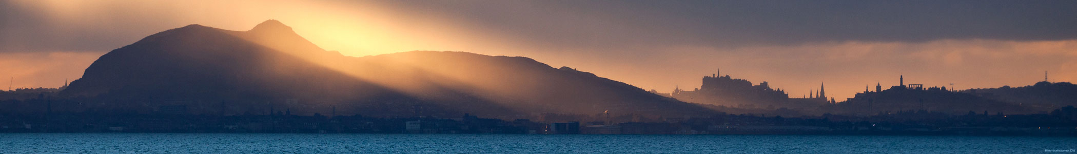
In 1911, a move was made to an entirely new building in Duncan Street, Edinburgh using as on the front the imposing Palladian facade of John George Bartholomew’s residence, Falcon Hall in Morningside, where the family had lived from 1899 to 1907 before it was demolished. To reflect the academic aspect of his work he gave his company premises the title of the Edinburgh Geographical Institute.
John George Bartholomew was a man of wide erudition and he initiated and carried forward projects of considerable magnitude. In 1895 The Survey Atlas of Scotland, uniting in one whole the sectional sheets on the scale of half an inch to the mile, which had achieved wide popularity and which had, since 1883, used layer-colouring to indicate altitude — a novelty first introduced in 1880, at his own suggestion, in the topographical maps included in Baddeley’s Guide to the English Lake District. These half-inch maps thus had the distinction of being the first topographical series in any country to make use of the layer-coloured system, now so generally accepted. The year 1898 saw the appearance of The Citizens’ Atlas, a large reference atlas of the world that long enjoyed a justly earned popularity in all kinds of settings.
at Merlindale, Drumelzier (Scottish Borders)
On 23 April 1889 he married Janet Macdonald (1858–1936), known as Jennie, the daughter of Alexander Sinclair Macdonald, JP, of Cyderhall, near Dornoch, Sutherland, with whom he had two daughters and three sons.
John George was reserved and studious, and his insistence on accuracy and quality in all his work made him a strict and exacting employer. He was also a benevolent one, however, who organized recreational activities and an innovatory company profit-sharing scheme for his staff. His friend Dr George Chisholm noted that, despite his ill health, he was ‘singularly, though quietly, happy, a natural result of the qualities in him which inspired confidence and affection among those who came into intimate contact with him.’ He was an elder at the United Free Church of St George, Edinburgh.
It was as a result of John George's flair and energy that the business prospered. The company changed from producing maps solely for specific customers to the status of a fully fledged publishing house with its own list.
In 1899, the first volume of the most important project ever planned by the Institute appeared — a physical atlas on a scale of unparalleled magnitude. It was The Atlas of Meteorology, designed to be the third volume of a series of seven. Although only two of the volumes were completed, (the second was The Atlas of Zoogeography in 1911) they gained world-wide recognition for their size, clarity, detail and artistry and were noteworthy for the many new features introduced under the stimulus of J. G. Bartholomew. Some of the maps specially designed for this series were subsequently incorporated in other text-books and atlases.
An expanded edition of The Survey Gazeteer of the British Isles followed in 1904. As well as the large-scale maps, these atlases contained smaller-scale variants illustrating geology and meteorology, and included some showing density of population — another novelty now regarded as a necessity. Up-to-date examples of them were specially prepared by Bartholomew, for reproduction in The Scottish Geographical Magazine, incorporating the results of the censuses of 1901 and 1911 in Scotland.
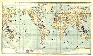
H.M.S Challenger, on this one plotting different algae
(click here to view a large version)
Other notable publications were The Survey Atlas of England and Wales in 1903, The Atlas of the World’s Commerce in 1907, employing material accumulated for Vol. VI of the major series, The Imperial Atlas of India in 1909 and The Historical Atlas of the Holy Land in 1915. From him came also the superb maps and charts for Sir John Murray’s famous Bathymetrical Survey of Scottish Freshwater Lochs. After the H.M.S. Challenger Expedition of 1873-76, John George worked with John Murray to map its findings.
Geographical Society
Outside the Geographical Institute, J. G. Bartholomew’s enthusiasm found yet other causes to espouse, and one of the first and naturally near to his heart was the founding of the Royal Scottish Geographical Society in 1884. He was one of its most active protagonists and did yeoman service in overcoming the many and far from insignificant difficulties that beset the path of the pioneers. From its inception until his death, he was one of its honorary secretaries, and he contributed both maps and articles to its magazine.
He also took a leading part in the establishment of the first Lectureship in Geography at the University of Edinburgh, though he would have liked it to be a Chair, and was among its earliest and most generous benefactors, both to the post and to the equipment of the department which followed. His eminence in his subject and his devoted public work gained for him honorary membership and medals of a variety of geographical societies, both at home and abroad, and in 1909 his old university bestowed upon him the honorary degree of LL.D. For the leading part he played in placing cartography in this country on a thoroughly scientific basis, and his distinguished services to geography, he was appointed 'Cartographer to H.M. King George V'.
In his later years he had to maintain a continuous battle with ill health and it was not an uncommon thing for him to send invaluable advice to the Society’s council from his sick bed. It may have solaced him a little that in his search for better health he embarked on travels which gave him glimpses of the other lands he had known so intimately, but from maps only.
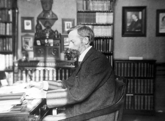
John George Bartholomew, L.L.D., F.R.S.E. from a portrait made in his early forties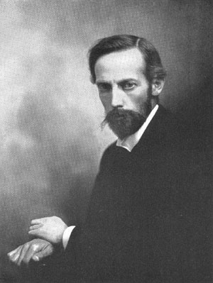
L.L.D., F.R.S.E. from a portrait
made in his early forties
John George began working on The Times Survey Atlas of the World (1922), a very detailed portrayal of the world and Europe after the changes of the First World War, with a sequence of specially prepared thematic maps. He did not live to see it completed, however, since he had to travel to Estoril in Portugal with his wife and daughters to regain his health. Despite moving to the healthier hills around Sintra, he died on 14 April 1920, and his remains were buried there in the cemetery of São Pedro de Penaferrim, located to the west of Lisbon.
A memorial to him was erected in the Dean Cemetery, Edinburgh where many of his family were later buried.
The first and subsequent editions of The Times Atlas made it one of the most important and respected atlases of the later twentieth century and a fitting memorial to John George's illustrious career. It is still updated and published regularly today at Collins Bartholomew.
[1] Abridged & adapted from 'John George Bartholomew - A Centenary' (Scottish Geographical Magazine 1960) Douglas A. Allen, C.B.E.
[2] includes extracts from the Oxford Dictionary of National Biography