III. John Bartholomew, junior
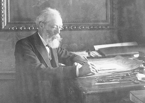
Spent much time in London and abroad visiting business contacts [1][2][3]

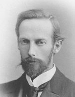
John Bartholomew junior was born in Edinburgh on December 25th, 1831 in Edinburgh. He was still very young when he acquired the skills of map drawing and engraving directly from his father, John Snr.
He was then sent to London for more formal training as a geographical draughtsman and engraver. He spent two years with the noted German geographer Augustus Petermann. His love for maps and geographical work soon led him to make rapid progress as a cartographer.
Returning to Edinburgh, he continued his father’s business with great energy, and, in conjunction with Dr Petermann, he contributed most of the maps to Fullarton’s Royal Illustrated Atlas, and to the Philip’s Imperial Atlas, drawn and engraved in Edinburgh. Other important works followed including Black’s General Atlas of the World; a large topographical map of Scotland on a scale of four miles to an inch; and afterwards a companion map of England and Wales from the survey just then completed.
In 1859, John married Annie McGregor, the daughter of John McGregor, a smith of Greenock. Following his first wife’s death in 1874 he married Anne Cumming Nimmo, the daughter of Primrose Nimmo, a master brass founder of Edinburgh, and his wife, Anne Philip, who was related to George Philip, the founder of the Liverpool map makers.
From his two marriages, John had two sons, and seven daughters.

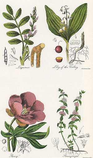
John was sought after as an engraver in Scotland for work outside his cartographic focus as well, including as illustrated here botanical drawings.
John had a reserved nature, which made him unwilling to enter fully into public life, but he took great interest in the reformation of the Scottish Rights of Way and Recreation Society (1880) and was elected a fellow of the Royal Geographical Society in 1857.
John travelled widely to obtain new work and introduced a programme of improvements, including the installation of lithographic printing, which brought considerable savings to the business from increased productivity.
His works attracted much public commendation, and received distinguished awards at different international exhibitions. About 1870, as the business gradually extended, several important atlases were undertaken for American and foreign publishers, the Handy General Atlas of the World being published simultaneously in England and America.
On a business trip in 1885 to North America to find work, John was on board RMS Germanic from Liverpool to New York when the ship was badly damaged by a tidal wave. You can read an extract from his diary about the terrifying incident here.
In 1888, he retired from active work, leaving the management of his business to his son, John George.
On a trip to London seeking special treatment, he died in March 1893 and was buried in Edinburgh.
The craftsmanship behind the first engraving of the map for Robert Louis Stevenson's Treasure Island in 1883 has not been irrefutably confirmed. John Bartholomew junior is said to have been commissioned to do this work but the original copperplate was lost. The replacement engraving in any case for the 1895 edition was produced at Bartholomew’s under his supervision.
[1] Bartholomew, 150 Years, Leslie Gardiner, 1976.
[2] includes extracts from the Oxford Dictionary of National Biography.
[3] Obituary of John Bartholomew, The Scotsman , April 1893.


