
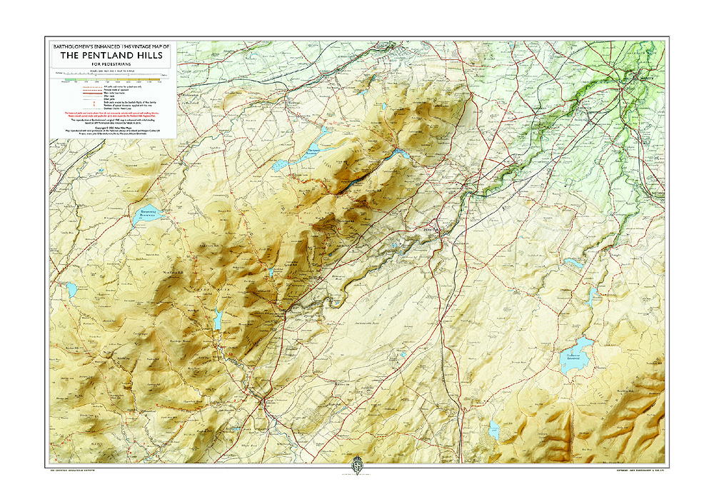
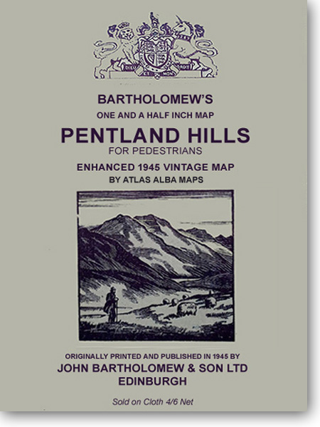
Bartholomew's Enhanced 1945 Vintage Map of the Pentland Hills, 2025
Reviving an old map with modern elevation data
New: Atlas Alba Maps, Bartholomew's Enhanced 1945 Vintage Map of the Pentland Hills.2025.
Available December 2025
About this enhanced 1945 vintage map
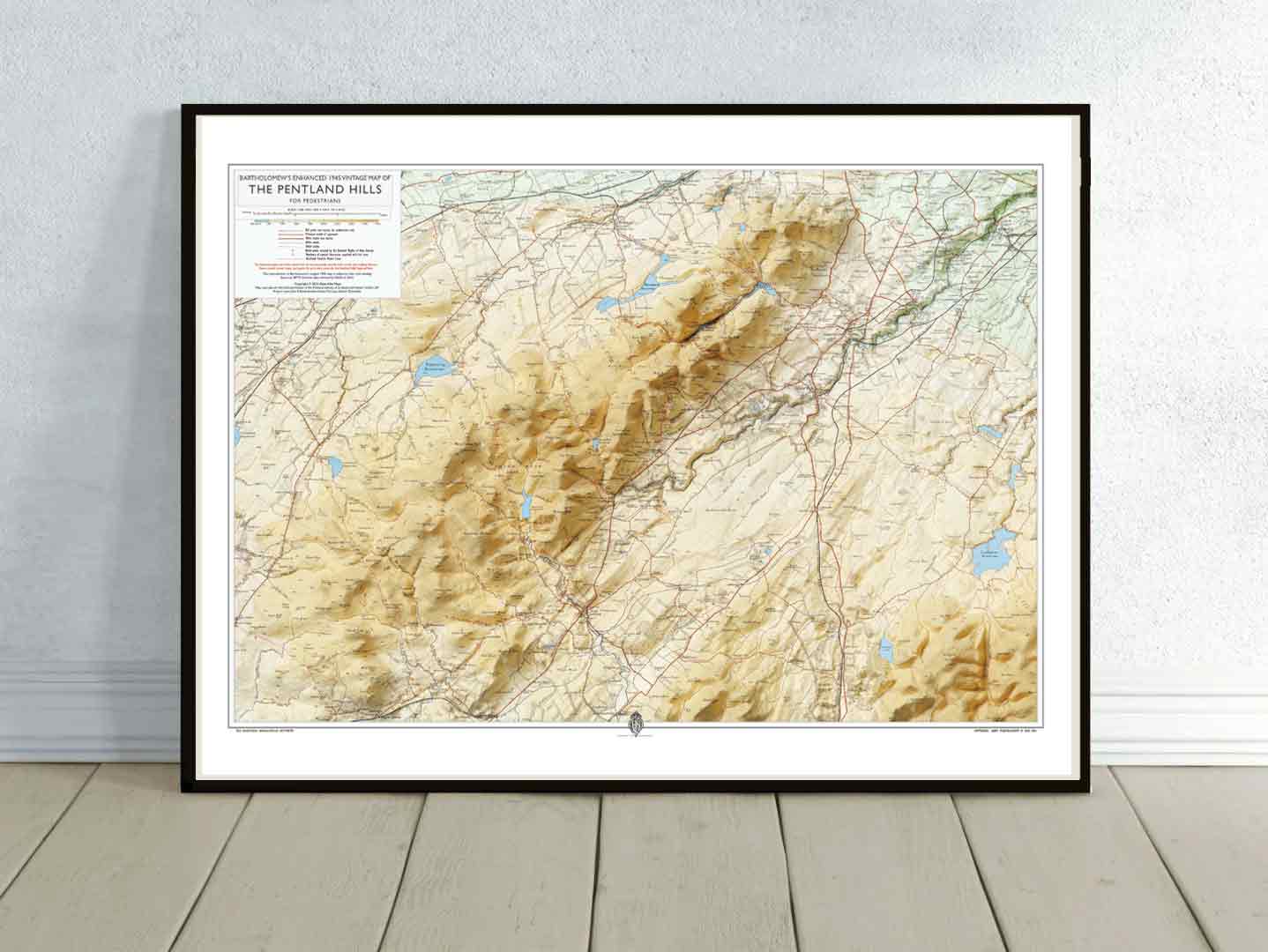
This project set out to give new life to a classic work by the renowned Edinburgh cartographers, John Bartholomew & Son Ltd. Working in partnership with Atlas Alba Maps, the team used a paper original from the National Library of Scotland, carefully scanned, cleaned, and digitally restored.
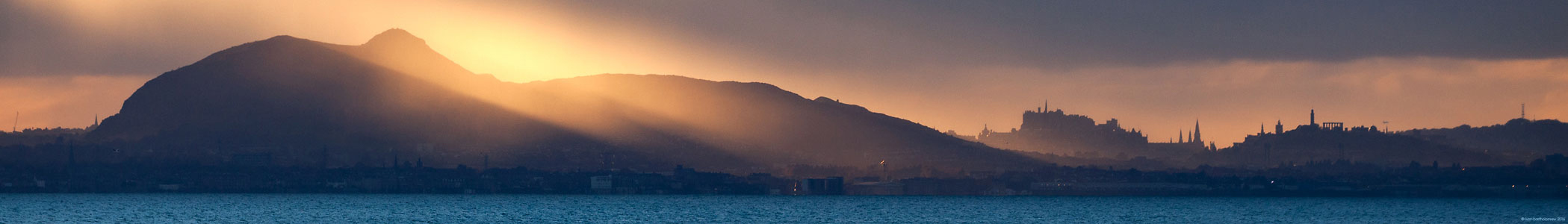
The restored map was enhanced with modern satellite elevation data. A digital “sunlight” effect was then cast across the landscape, creating a subtle 3D appearance. Achieving this required extensive experimentation with light, colour, and detail, followed by multiple test prints and refinements to ensure accuracy and quality.
The enhanced map will be available in a range of printed formats, both framed and unframed. For more information, scroll to bottom of this page or click here.
A short history of mapping the Pentland Hills over 350 years
The earliest known depiction of the Pentland Hills appears in A New Description of the Shyres Lothian and Linlitquo. This map was engraved by Hendrik Hondius and published in Amsterdam in 1630.
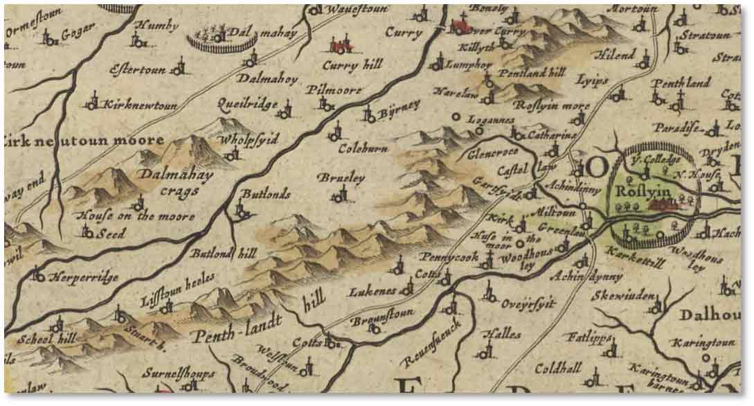
T. Pont / H.Hondius, A New Description of the Shyres Lothian and Linlitquo.1630.
Courtesy of the National Library of Scotland
William Roy’s Military Survey of Scotland (1747-55) included more detailed images of the Pentlands. This was not a fully triangulated survey in our modern sense. The maps were sketch maps which recorded names of some of the summits like Castlelaw, Lawhill, and other features in more detail than previously.
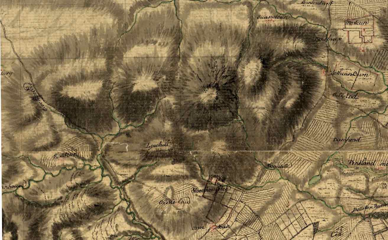
William Roy’s Military Survey of Scotland (1747-55) : Extract of northern edge of Pentland Hills
Copyright: The British Library Board
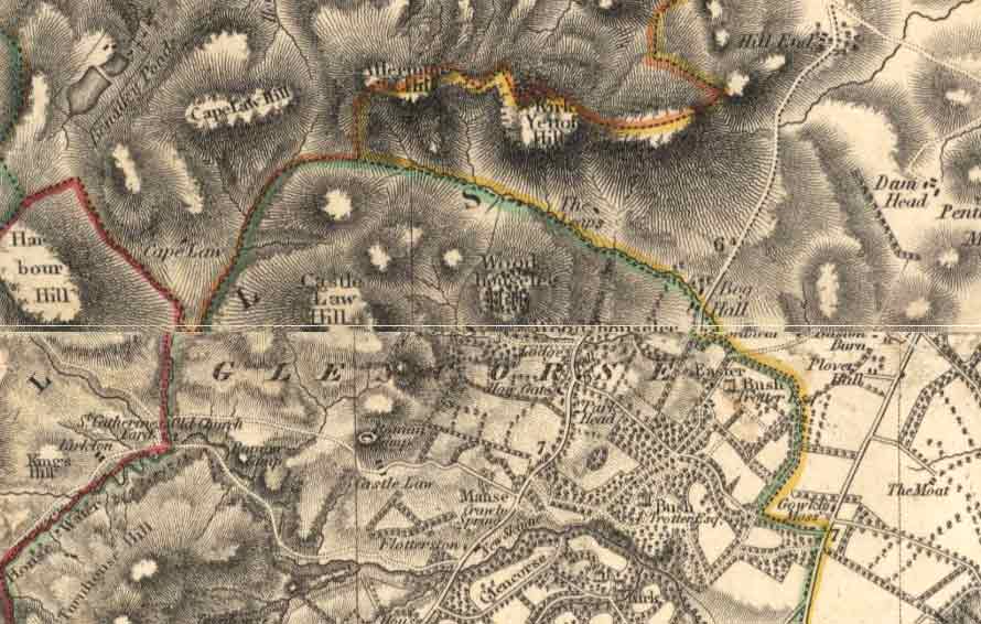
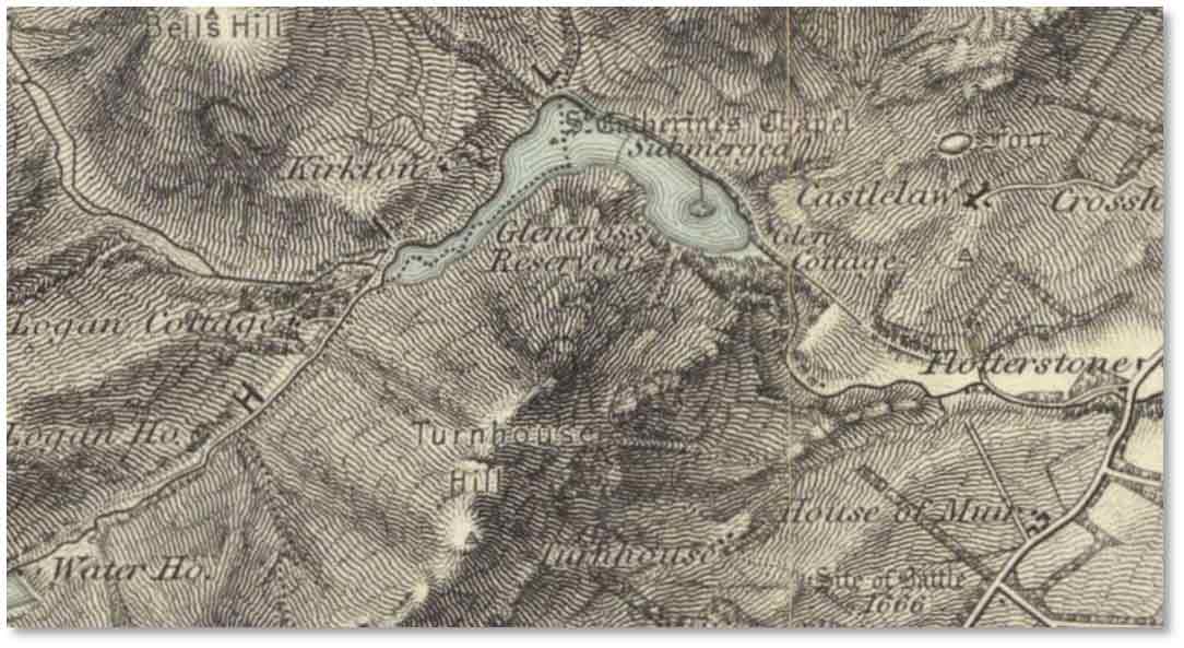
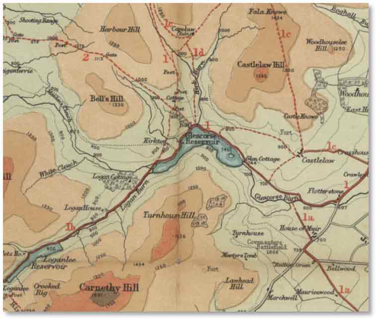
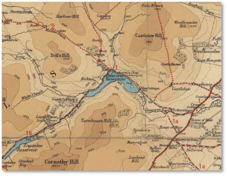
In the early 19th century, the Edinburgh-based Bartholomew family began engraving detailed maps of the city and its surrounding areas. An example is by George Bartholomew in 1825, for Lothian’s Plan of the City of Edinburgh and Vicinity which includes the northern end of the Pentland Hills. This work predates the Ordnance Survey maps of Scotland by some thirty years. Note that Glencorse Dam and Reservoir, though completed in 1824, didn't quite make it on this map.
George Bartholomew engraver: Lothian’s Plan of the City of Edinburgh and Vicinity, 1825.
Courtesy of the National Library of Scotland
In 1821, John Thomson, an Edinburgh-based engraver completed the task of creating the most comprehensive Atlas of Scotland of his time. He compiled maps from multiples sources including earlier county maps, military surveys, estate plans and local correspondents.
John Thomson: Edinburghshire sheet, Atlas of Scotland 1832, imprint 1821
Courtesy of the National Library of Scotland
The first Ordnance Survey One Inch of Edinburgh was published in 1857. A year later, a version appeared that depicted relief with hachures (lines following the direction of the slope), showing the topography of the Pentland Hills in greater detail.
Ordnance Survey, One-Inch to the mile, Scotland, Sheet 57 (Edinburgh), First Edition (Hills), 1858.
Courtesy of the National Library of Scotland
George Bartholomew’s grandson, John Bartholomew, junior (1831–1893), took a keen interest in preserving public access rights in Scotland. In 1884, he became one of the first directors of the Scottish Rights of Way and Recreation Society. In 1885, the Society (now known as Scotways) published The Pentland Hills: Their Paths and Passes (the first guide). That edition included a map by John Bartholomew, showing the paths.
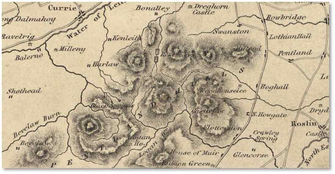
Also in 1885, John engraved the original Pedestrian’s Map of the Pentland Hills in 1885, published by Gall & Inglis, Edinburgh, at a scale of 1½ inches to the mile. During the late 1870s, he pioneered a system of representing height through “layer colouring,” using greens and browns for plains and foothills, darker browns for high ground, white for mountain tops, and blue for water. Though initially slow to gain popularity, this technique became a hallmark of Bartholomew cartography and later of many other cartographic publishers worldwide.
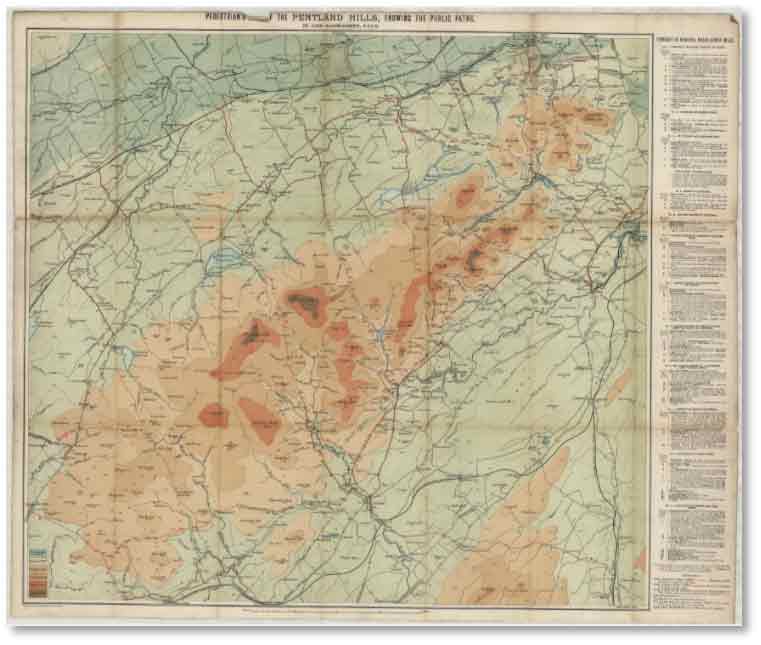
John Bartholomew junior, Gall & Inglis, Pedestrian’s Map of the Pentland Hills, 1885.
Courtesy of the National Library of Scotland
The map was updated by John George Bartholomew in 1897 and revised several times thereafter. The 1945 edition, still mostly based on the engraved original of 1885, has extended coverage northwards to the Firth of Forth, incorporating routes and paths in and around Edinburgh.
John Bartholomew & Son Ltd, Map of the Pentland Hills and Edinburgh District, 1945.
Courtesy of the National Library of Scotland
Sheet 32 of the Geological Survey of Scotland (One-Inch Series) covers the Pentland Hills area. The 1930 edition maps the region’s Silurian and Devonian rocks, including volcanic lavas, sandstones, and greywackes, as well as faults and glacial deposits.
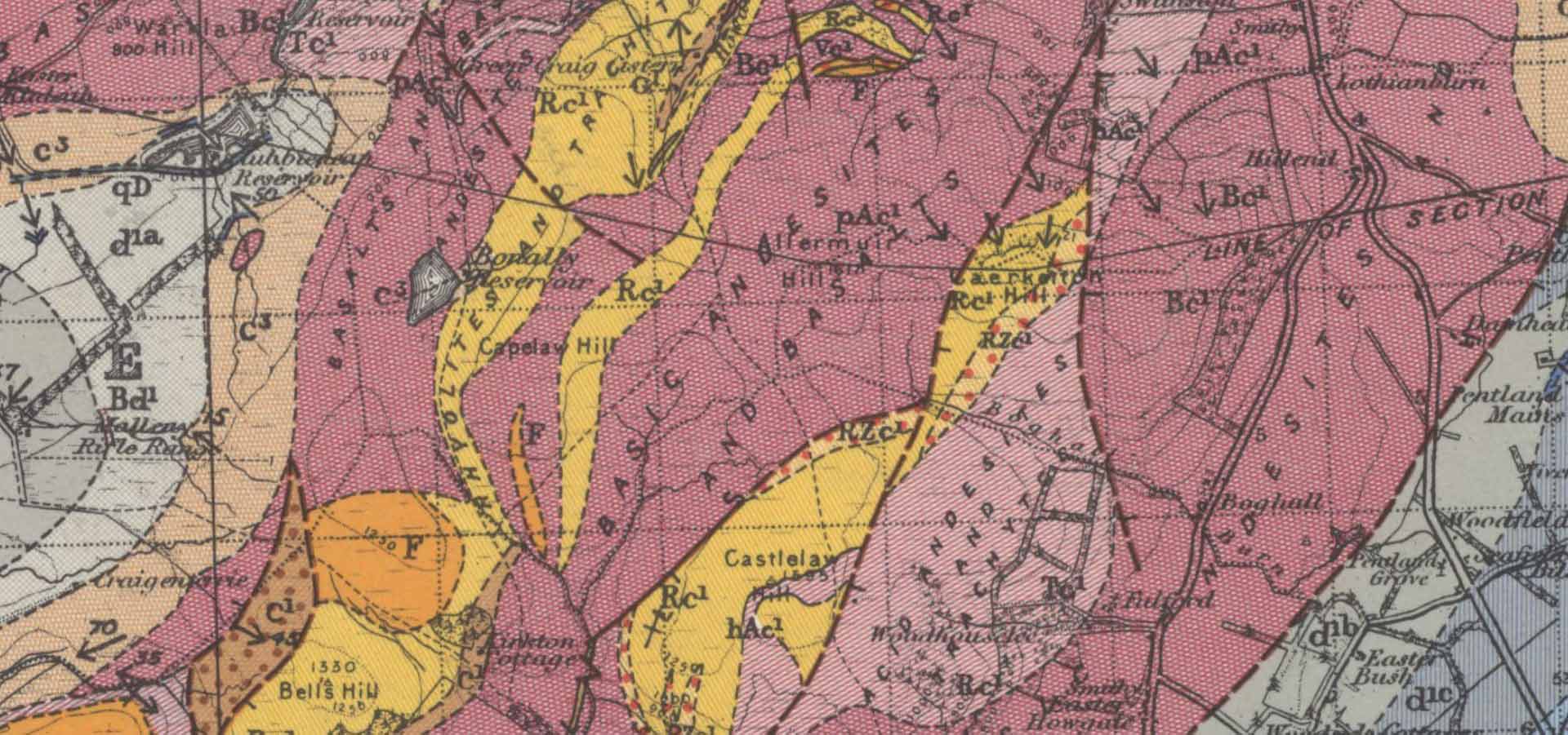
Courtesy of the National Library of Scotland
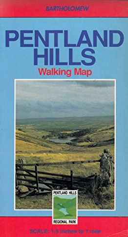
The last commercial Bartholomew edition of the Pentland Hills Walking Map was published in 1990 by HarperCollins UK, in association with Lothian Regional Council.
Today, the official map of the Pentland Hills Regional Park is issued by the City of Edinburgh Council. First published in 2016, it provides current information on paths, facilities, and amenities. Copies are available free of charge at the park’s visitor centres at Flotterstone and Harlaw House. The second map below published by the Friends of the Pentlands extends the southern extent of the Pentland Hills to Carnwath in the Southwest and beyond Dolphinton to the East.
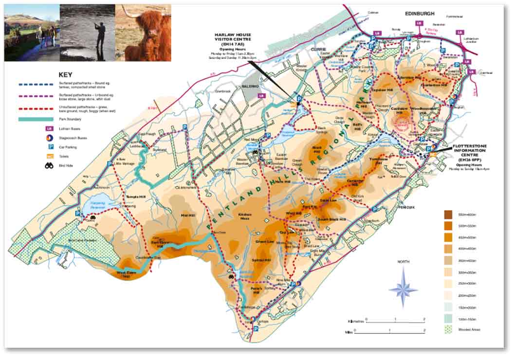
City of Edinburgh Council, Pentland Hills Regional Park Map, 2016
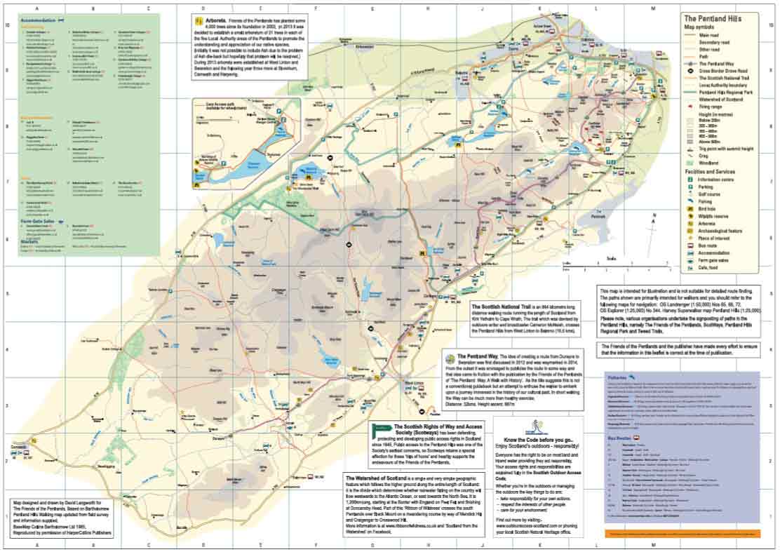
Friends of the Pentlands map featuring the Pentland Way. Cartography: David Langworth, 2011
The Scottish Rights of Way and Access Society (Scotways) have a long tradition of publishing maps to share an accurate record of the Rights of Way throughout Scotland. Their first guidebook, The Pentland Hills: Their Paths and Passes, was published in 1885 including a map by John Bartholomew Jr. Since 1947, successive editions of Scottish Hill Tracks books have maintained up-to-date maps and access descriptions in a compact form.
Pentland Hills area map from ScotWays’ Scottish Hill Tracks book, published by Scottish Mountaineering Press, 2024. Contains OS OpenData, Crown Copyright., 2024
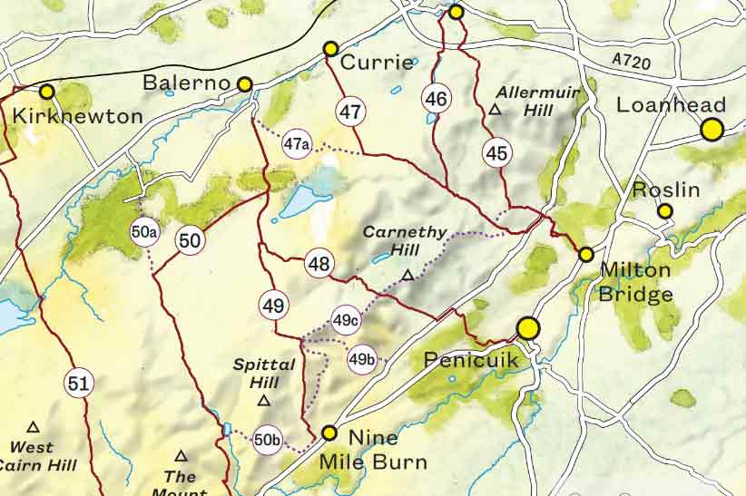
For field use, the Ordnance Survey’s Explorer Series Map, Sheet 344 (1:25,000 scale) is recommended, available in both paper and digital formats. Harvey Maps also produce a detailed walking map of the Pentland Hills Regional Park, likewise at 1:25,000 scale, designed specifically for walkers.
OS Explorer Series Sheet 344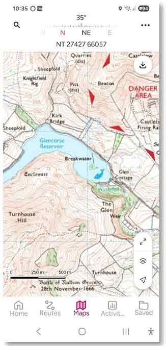
OS Maps App, Pentland Hills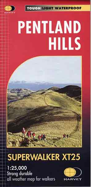
Harvey Maps, Pentland Hills
Besides the official OS Maps App, the Pentlands are mapped today on different online platforms. Of these, the crowd-sourced OpenStreetMap (OSM) presents ever-growing content in multiple layers, constantly enriched with local contributions from many local mapping, hill-walking and cycling enthusiasts.
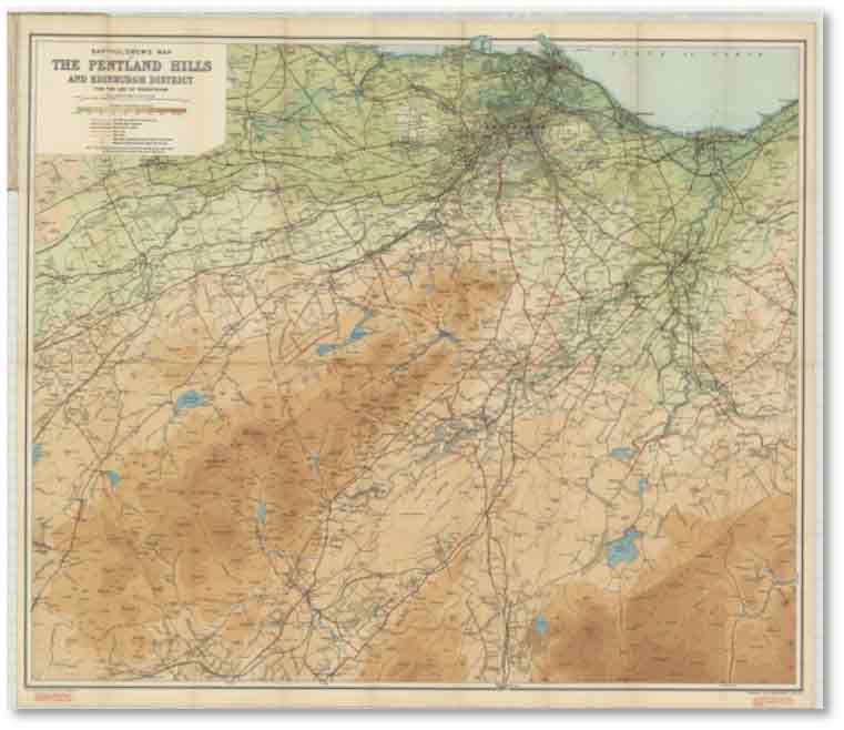
Bartholomew's Enhanced 1945 Vintage Map of the Pentland Hills
Available from December 2025
The first edition of the Bartholomew's Enhanced 1945 Vintage Map of the Pentland Hills is now available as a wall map for purchase.
At an original scale of One and a Half Inches to the Mile (1:42,240), this experimental version is produced with high quality printing on fine paper, sold flat both framed and unframed. Atlas Alba Maps list this publication with their fine art map prints of Scotland. Initially this version is offered to enthusiasts of the Pentland Hills exclusively from local physical outlets in the Edinburgh area (Online purchase options will be announced later).
Bartholomew's Enhanced 1945 Vintage Map of the Pentland Hills, Available December 2025
Format: A1 (841 x 594 mm)
Product description: Crafted for this first limited deluxe edition, each print is produced locally about two miles from the eastern slopes of the Pentland Hills. The printers at GMP Solutions* are carbon-balanced using state-of-the-art, high-quality inkjet technology. Printed at A1 size (841 × 594 mm) on 200 gsm satin uncoated paper. To enhance both appearance and longevity, the print undergoes UV curing — a process that delivers sharper detail, richer colour depth, and more durability. Once cured, the ink forms an invisible resilient, cross-linked polymer layer that remains lightfast for years, especially when framed. Your map is inspected and packaged by hand into a vintage-labelled presentation tube, making it ideal for gifting or safe storage.
10% of sales of this map are donated to the Friends of The Pentlands
charity, to support their volunteering activities.
* Since 2016, GMP Solutions has finded the planting of a total of over 30,000 trees! These include native Scottish trees planted by the volunteers of the Friends of the Pentlands to offset the carbon produced in the manufacture and distribution of their printed products.
Where can you buy this map?
Official sales agents:
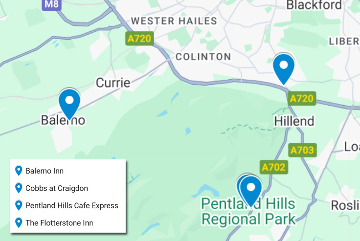
The Flotterstone Inn, Penicuik,EH26 0PP
Pentland Hills Cafe, Penicuik,EH26 0PR
The Balerno Inn, Balerno, EH14 7EQ
Colinton Arts, Balerno, Edinburgh, EH13 0LQ
The Knot, West Linton, Edinburgh, EH46 7EA
Friends of the Pentlands, contact@pentlandfriends.org.uk
Online sales: Not yet available
For all enquiries about this map, please contact us at: maps @ johnbartholomew.com
We can recommend good, inexpensive framing solutions.