
St. Winifred's Island, Loch Lomond
A charming family story [1]
Click here to view hi-res version.
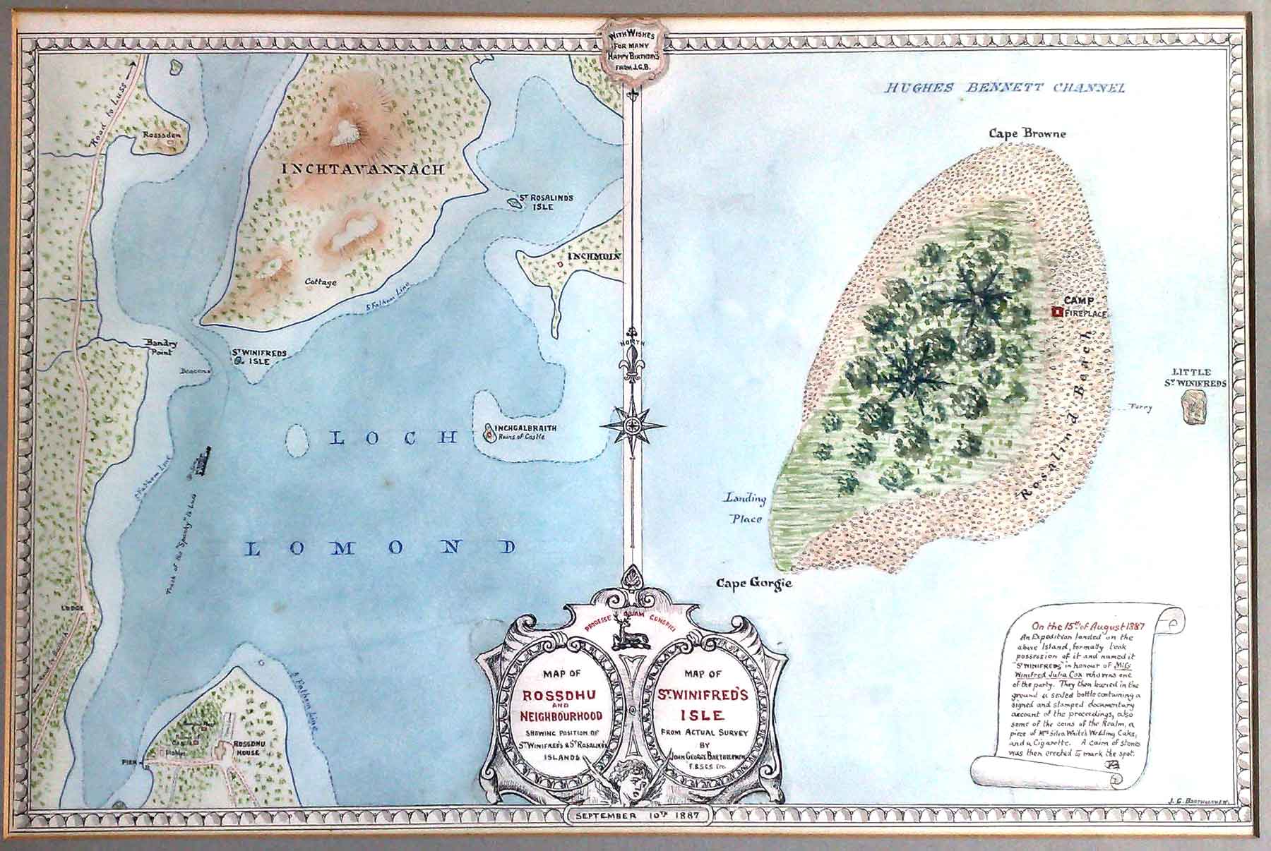
One small but significant item which illustrates the relationship between maps and adventure is the delightful map drawn in September 1887 by John George [Bartholomew] as a 9th birthday present for Winifred Cox (1878 - 1905). Robert Cox, M.P., of Gorgie, Edinburgh, had leased Rossdhu House, Luss, on the banks of Loch Lomond, for four years. John George made the house his headquarters while undertaking some survey work in the area, possibly for the Royal Scottish Geographical Society’s Atlas of Scotland published in 1895.
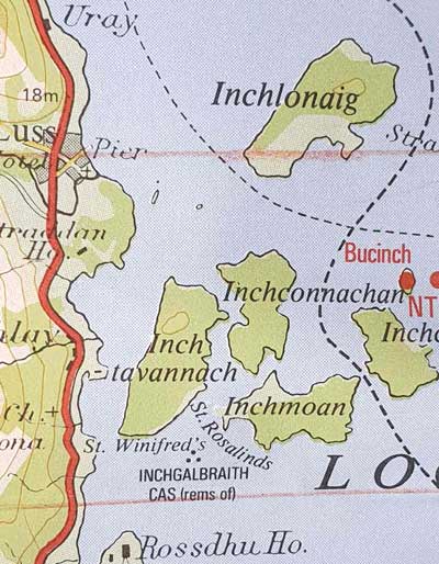
1:100,000 National Series Sheet 44
in 1985.
On 15th August 1887 an “exploratory picnic” as it was called by Winifred’s brother Harold was held. Where better place for such a venture than an uninhabited and un-named island. After all Treasure Island had first appeared in book form only four years earlier, and the cartography for the map of [Treasure Island] had been done by Bartholomews. A full explanation of the events of the day is given on a scroll forming part of the map made by John George and given to Winifred to celebrate her birthday.
The text reads as follows:
'An expedition landed on the above island, formally took possession of it and named it ‘St Winifred’s’ in honour of Mifs Winifred Julia Cox who was one of the party. They then buried in the ground a sealed bottle containing a signed and stamped documentary account of the proceedings, also some of the coins of the Realm, a piece of Mrs Silva White’s Wedding Cake and a Cigarette. A cairn of stones was then erected to mark the spot.'
In the use of the “f” for a second “s” in Miss, John George implied elements of an ancient map as betokens an “expedition” and obviously fully entered into the fun of that day. The fun was to last however as in Bartholomew’s Half Inch Maps of the area, the island continued to be called St Winifred’s rather than follow [Ordnance Survey] usage. Even today can there be any better way of introducing a young person to the lasting joy of a spirit of adventure and exploration than an exploratory picnic and a map to remember it by.>/p>
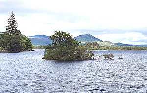
In reality the islands are minuscule. Here is a photo taken from a cruise boat during the international family gathering of 2022.
[1] From The Bartholomews and The R.S.G.S. (GeogScot - September 1993).